Heavy rain, strong winds for South Island road users
NZ Transport Agency Waka Kotahi | 25 Mar 2026 5:29pm | West Coast, Canterbury, Otago
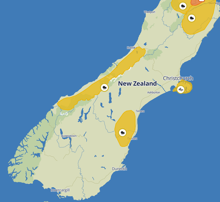
While the North Island is expected to bear the brunt of an approaching large weather system, the central and lower South Island is still expected to feel its effects, and road users are being encouraged to travel with care.
MetService is warning of the potential impacts of a deep sub-tropical low affecting the country from tonight.
It has heavy rain watches in place for the Ranges of the Westland District, from 3pm tomorrow through to 3am Saturday, and for North Otago and Canterbury south of Timaru and east of Twizel, from 6pm tomorrow through to 6am Friday. Rainfall amounts may approach warning criteria, MetService says.
On Canterbury’s Banks Peninsula, a strong wind watch is in place from 7pm tomorrow until 7pm Friday due to northeast winds that may approach severe gale force.
NZTA urges all road users to take extra care when travelling in strong winds, especially those in high-sided or towing vehicles and on motorcycles. Heavy rain means slippery roads and drivers should think about adjusting their speed and travelling distances, avoiding sudden braking, and staying visible.
Stay up to date on weather warnings at MetService, and on state highway conditions and restrictions at our Journey Planner site.